
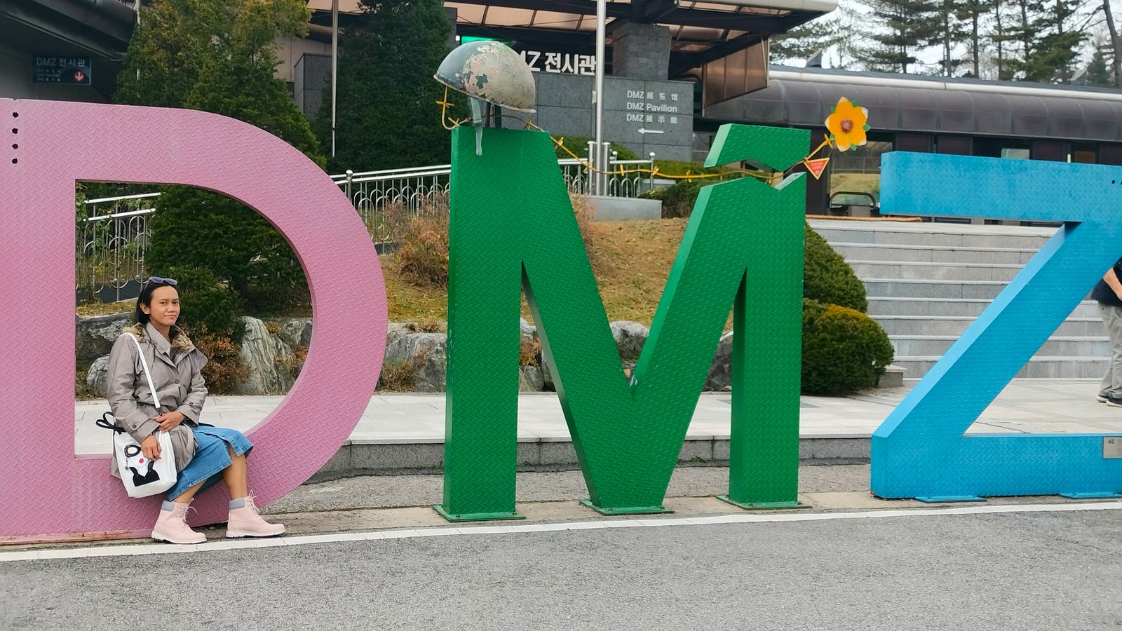
On our last day in South Korea, my friend Hannah and I decided to deviate from our original plan and embark on a DMZ tour. Well, technically, it was more like me persuading her: “I really want to visit the DMZ, are you up for it?” Thankfully, she agreed.
Had she declined, I would’ve gone solo — even though the DMZ had been closed to tourists the previous week due to North Korea’s ballistic missile launch (as confirmed by our tour guide).
About the Korea DMZ
The Korean Demilitarized Zone (DMZ) is a strip of land running across the Korean Peninsula near the 38th parallel north. This border barrier divides the peninsula roughly in half, serving as a buffer zone between North Korea and South Korea.
It was established in 1953 under the Korean Armistice Agreement signed by North Korea, China, and the United Nations Command.
Today, the DMZ is one of the most heavily militarized regions in the world and spans 248 km from Jeongdong-ri, Paju-si, to Myeongho-ri, Goseong-gun. While its primary purpose is peacekeeping, it has also become a significant tourist destination.
Source: Wikipedia
Booking the Tour
I booked our DMZ tour through Klook just two nights before the trip. The highlights included:
- Learning about the history of the Korean War and the Cold War
- Visiting notable locations like Imjingak Park, the Freedom Bridge, the Third Infiltration Tunnel, Dora Observatory, and the DMZ Exhibition Hall
- Using binoculars to catch a glimpse of North Korea from observatory towers
Despite the DMZ’s reputation as a heavily-armed and dangerous border, the overwhelmingly positive reviews on Klook reassured me. I figured this might be my only chance to visit, so I went for it.
The Early Morning Start
According to the Klook activity page, the tour starts around 8 AM. However, due to high tourist demand, our guide informed us via WhatsApp the night before that we’d need to leave at 3 AM to secure tickets. Fortunately, hotel pick-up was included, so we didn’t need to find transportation in the early hours.
Our private car picked us up, stopped at another hotel for more tourists, and dropped us at a bus already full of people. The two-hour ride to the DMZ was dark and foggy, adding an eerie atmosphere to the journey.
Upon arrival, we were reminded of the strict no-photo policy at military checkpoints. Military personnel checked our passports twice: once upon entry and once upon exit. Each of us had to match our passport with a list and confirm our identity — a sobering reminder of the border’s significance.
First Stop: Imjingak Park
Our first stop was Imjingak Park, located within 7 km of the Military Demarcation Line. Dedicated to the 10 million South Koreans separated from their families during the peninsula’s division, the park is now a hub for DMZ-related tourism.

The park was colder than Seoul — a chilly surprise for my tropical-weather-acclimated self. Thankfully, I had packed a coat just in case.


One of the park’s key features is the steam-powered train preserved at the Imjingak Pavilion. The bullet holes covering its body serve as a stark reminder of the Korean War.


There’s also the Peace Gondola, the world’s only gondola traveling through the Civilian Control Zone (CCZ). Unfortunately, we couldn’t ride it due to time constraints.
The Imjingak Peace Gondola is the world’s only gondola that travels the Civilian Control Zone (CCZ) area. Through the 1.7 km-long gondola, passengers can easily visit the CCZ or between the north and the south beyond the Imjingang River and appreciate the DMZ area with speed and comfort.

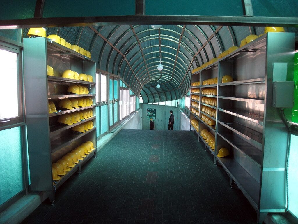
Second Stop: DMZ Station and Third Infiltration Tunnel
Next, we visited the DMZ Station and its exhibition hall, followed by the Third Infiltration Tunnel.
Our guide shared that North Korea initially claimed the tunnel was for coal mining. However, the absence of coal in the area led South Korea to conclude it was meant for a military invasion.
It is estimated that approximately 30,000 soldiers could move through the tunnel per hour and was thought to be more threatening as an invasion tool than the 1st and 2nd Tunnels.

About The Third Tunnel
The Third Tunnel of Aggression (Korean: 제3땅굴) or Third Infiltration Tunnel is one of four known tunnels under the border between North Korea and South Korea, extending south of Panmunjom.
The South Koreans have blocked the actual Military Demarcation Line in the tunnel with three concrete barricades. Tourists can walk as far as the third barricade, and the second barricade is visible through a small window in the third.
Taking photos in the tunnel was not allowed so we had to leave our phones and other belongings inside one of their free lockers in the lobby. Get the key, bring your water, and then head to the tunnel.
It wasn’t your usual hot, dusty, and dark tunnel — you’ll find that it’s very tourist-friendly. The tunnel is 1,635 meters long and lies 73 meters below ground.
Despite being well-lit, air-conditioned, and equipped with safety measures, the tunnel’s steep incline and confined space make it a challenge for the claustrophobic.
There was a bench and an oxygen tank or mask every few kilometers, and there was a railing you could hold while walking.
I also saw emergency responders outside the tunnel ready to assist in case someone needed help, plus there were also CCTV cameras all over.
You have to wear a construction helmet and truly it’s for good measure. I bumped my head a couple of times. There were also slippery parts so we really had to be careful. Gladly, we made it to the end of the tunnel that was open to tourists — exhausted but safe nonetheless.
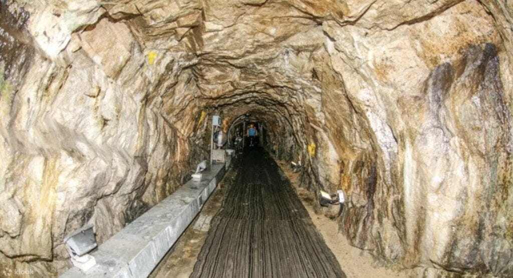
That might have been an old photo because when we were in the tunnel, there were railings on each side and the ground was not quite like that. It was cleaner and more polished, so I’d say there had been improvements made to make it safer and easier for tourists.
Going inside is a downhill walk so it was a bit easier, albeit trickier because if you’re not careful, you might find yourself rolling to the deep end. 😅 Even though you can go at your own pace, somehow you’ll feel like the people walking behind you put pressure on you to walk faster.
Going out of the tunnel is another story because it’s an uphill walk. You’ll need to have more energy and willpower. Upon going back, we also saw a monorail or motorized trolley that could transport people in and out.
I think it was not working when we went because nobody used it. Walking was more fun though and we burned some calories there so it’s a win-win.
I didn’t know how long it took us to complete the entire walk but my legs hurt after, so yeah, that’s probably one heck of a walk.
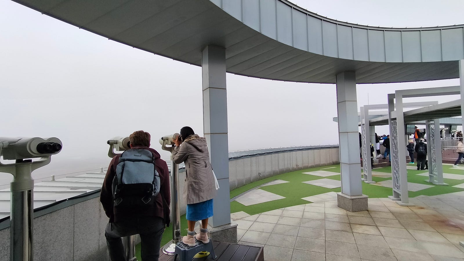
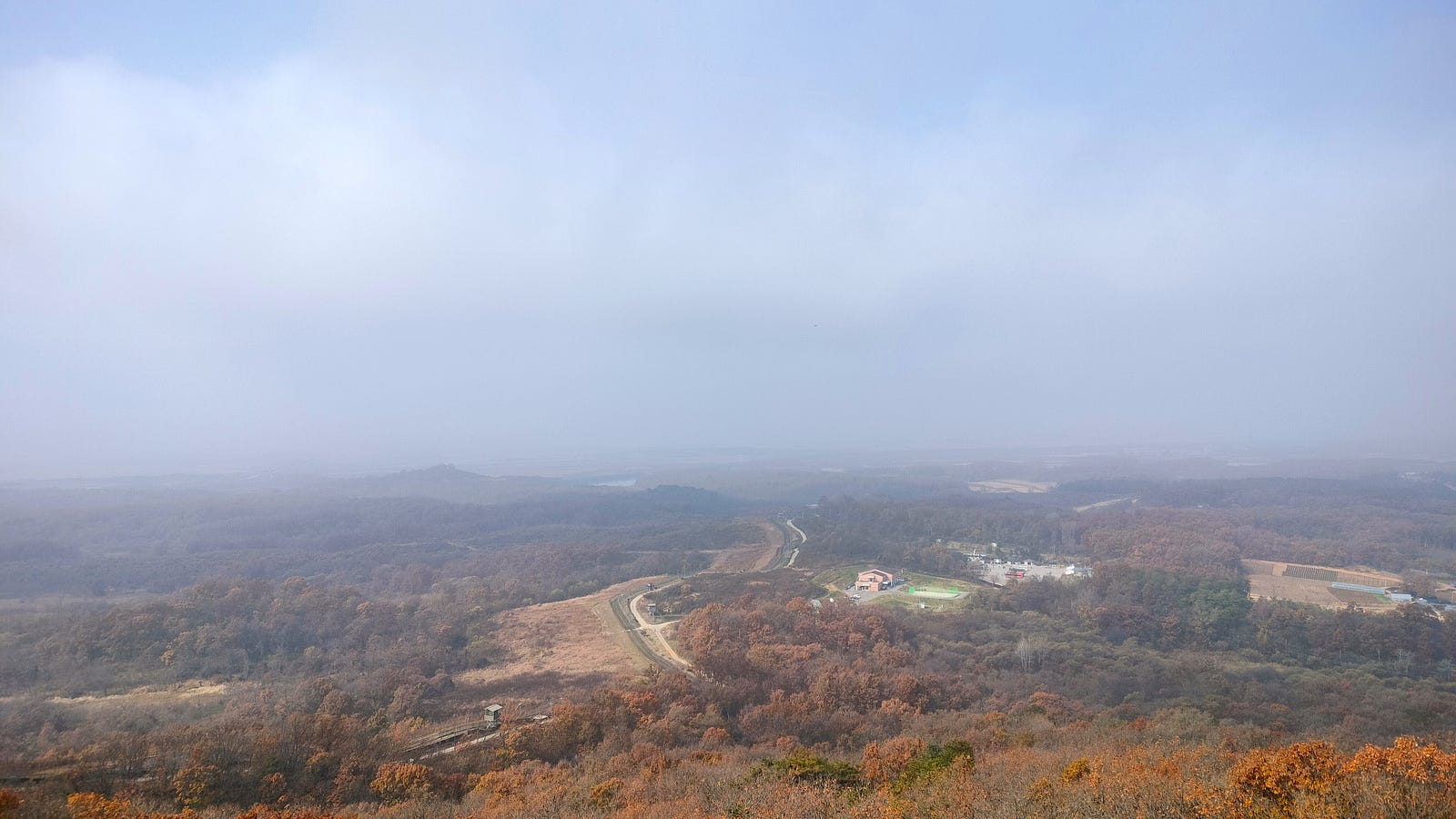
Third Stop: Dora Observatory
The final stop was Dora Observatory, the closest point to North Korea that tourists can access. Unfortunately, heavy fog obscured our view initially, but after a few minutes, it cleared up slightly. Using binoculars, we could spot parts of the North, including its propaganda village and the city of Kaesong.
Dora Observatory is located on Mount Dora and can accommodate up to 500 people. It’s a surreal experience to stand on the edge of one of the world’s most tense borders and look into another country.

What About the JSA?
You might wonder about the famous Joint Security Area (JSA), where North and South Korean forces stand face-to-face. Unfortunately, it wasn’t part of our itinerary, as tours to the JSA were suspended during the pandemic. However, I’ve read that they may have resumed recently, and I’d love to visit it on a future trip.
Highly Recommended
Our DMZ tour was truly an unforgettable experience that combined history, education, and adventure. I think it’s a must-visit for anyone interested in Korean history or geopolitics.
Would I recommend it? Absolutely. And if given the chance, I’d even go for round two! I’d do it all over again and visit the rest of the places we missed.